The Time When Facts Became Territory
How climate science redefined Greenland’s future.
Part 3 of a five-part series on science diplomacy and sovereignty in the Arctic.
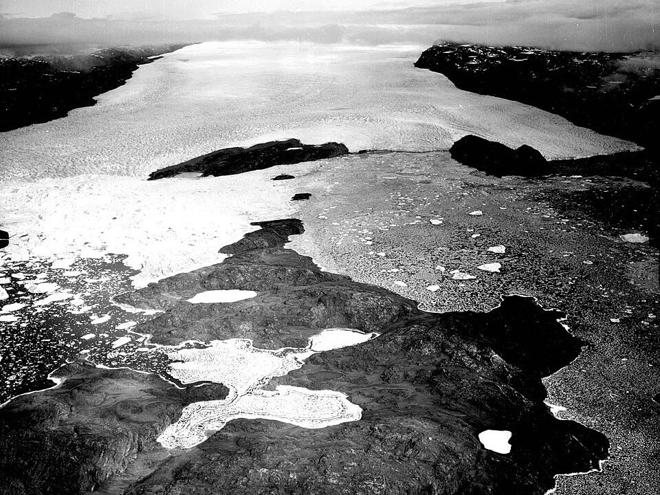
In Arctic politics, silence often signals victory more eloquently than any declaration. After Danish scientists disproved the Peary Channel, Heilprin Land stopped being an argument.
Once the channel vanished from the map, the source of Heilprin Land's diplomatic volatility collapsed, rendering treaties, protests, and symbolic gestures obsolete.
The land remained where it had always been: connected, continuous, and unambiguously Greenlandic. The dispute dissolved because one side’s claim could no longer be sustained within a shared factual framework.
Sovereignty has often been settled in the polar regions through the elimination of plausible alternatives. A place becomes uninteresting only after it becomes indisputable.
By the early twentieth century, Denmark no longer needed to assert ownership of Heilprin Land, named for scientist Angelo Heilprin. The assertion had been embedded, slowly and methodically, into the scientific record. Cartographic surveys replaced speculation. Repeated traverses replaced heroic narratives. The accumulation of data rendered further debate unnecessary.
In this sense, Heilprin Land and the broader region it is located within known as Peary Land, the northernmost landmass of Greenland named after explorer Robert Peary, did not so much become Danish as it became boring. And boredom, in international law, is a powerful stabilizer.
But that boredom had to be manufactured.
The Labor of Certainty
Peary’s false assertion that a channel separated part of northeast Greenland from the rest of the island, potentially clearing the way for the U.S. to claim the territory above the channel under international law, prompted Danish explorer Ludvig Mylius-Erichsen to lead a team there in 1906 to map its uncharted areas.
The Danmark Expedition, which collected new data but lost its leader and two other men, is often remembered for its conclusion that the Peary Channel did not exist and less for the uncertainty that preceded it. Danish field notes from the expedition reveal a landscape that was anything but self-evident. Visibility shifted by the hour. Fjords masqueraded as straits. Ice behaved inconsistently, sometimes concealing continuity, sometimes exaggerating separation.
One surveyor recorded a day in which the ice appeared to open into what looked unmistakably like a channel, only to close again by nightfall under drifting snow. Another noted the difficulty of distinguishing between landfast ice and true land connection in low winter light. The map, in these conditions, mirrored a hypothesis under constant revision.
What Denmark achieved was persistence. The same routes were measured again and again, under different seasons and conditions, until ambiguity gave way to confidence. The Peary Channel did not vanish because it was disproven once. It vanished because it could not survive repetition.
This mattered because international law rewards continuity. To govern a place that cannot be settled, a state must show that it can return — intellectually, institutionally, predictably.
Denmark did exactly that.
Knowledge as Occupation
The episode revealed a deeper transformation underway in how territory was claimed and maintained in environments hostile to settlement. Traditional markers of sovereignty, such as towns, taxation, and permanent populations, were impractical in the Arctic. What replaced them was a different currency of authority: the capacity to observe, measure, and return.
Denmark, a small state with limited military reach, understood this early. Its Arctic strategy relied less on projection of force than on continuity of presence through science. Meteorological stations, geological surveys, mapping expeditions, and ethnographic research formed a lattice of attention that stretched across Greenland. The message was implicit but clear: this land was known, revisited, and taken into account.
Knowledge became a proxy for governance.
This approach would later be codified in the doctrine of effective occupation, but its logic was already evident in practice. To occupy a place was no longer merely to be there; it was to demonstrate the ability to understand it. In temperate regions, that understanding took administrative forms, such as registries, courts, and censuses. In the Arctic, it took scientific form.
The Danmark Expedition exemplified this shift. Its purpose was verification. Its success lay not in naming new features, but in denying the existence of one that had already been named. By proving the Peary Channel illusory, Danish scientists closed a legal opening that might otherwise have persisted for decades.
Three died in the effort, succumbing to exposure and starvation while attempting to return to base camp. Dying from frostbite and hunger in a small cave, explorer Jørgen Brønlund made a final diary entry: “I reached this place under a waning moon, and cannot go on, because of my frozen feet and the darkness.”
More than a century later, that same diary entry proved useful to scientists because of the black dot it contained on the paper. It was just a tiny bit of evidence, about the size of a sesame seed, and it took a team of researchers at the CERN, the world’s biggest particle physics lab on the outskirts of Geneva, to properly analyze it.
The findings, published in the journal Archaeometry in 2020, showed burnt rubber, oil and feces in the black speck, but no paper. It suggested Brønlund had spent his final hours trying to light a petroleum stove, but he had not resorted to using the paper from his diary, which held evidence that Peary Land was a peninsula. The preservation of knowledge was paramount.
The importance of that act cannot be overstated. Had the channel existed, Greenland’s northern territories could plausibly have been treated as separate islands, unconnected to the Danish-settled south. Under nineteenth-century international law, such islands, if not demonstrably governed, could be claimed by other powers through discovery and use. Peary’s error, intentional or not, momentarily reopened that possibility.
Its correction foreclosed it.
Courts, Precedent and the End of Ambiguity
The legal implications became explicit in 1933, when the Permanent Court of International Justice ruled on competing claims in East Greenland. In rejecting Norway’s attempt to assert sovereignty, the court emphasized Denmark’s long-standing scientific engagement with the island. Continuous exploration, mapping, and research were treated as evidence of authority. Knowledge production, the court implied, was not neutral. It was jurisdictional.
This ruling did more than settle a dispute between Denmark and Norway. It became a cornerstone of international law on territorial sovereignty, establishing a precedent for how nations could assert control in regions where conventional governance was impossible.
“A claim to sovereignty based not upon some particular act or title such as a treaty of cession but merely upon continued display of authority, involves two elements each of which must be shown to exist: the intention and will to act as sovereign, and some actual exercise or display of such authority,” the judges ruled.
Science, conducted systematically and institutionally, could anchor sovereignty, even over, or particularly in, the world’s most remote, sparsely populated regions.
Scientists, in this framework, became more than observers. They were agents of government presence, regardless of their intent. Their measurements fixed borders; their reports stabilized claims; their corrections prevented escalation. Accuracy itself became a diplomatic act.
Angelo Heilprin grasped this intuitively long before the courts formalized it. He believed that facts, once established, constrained ambition. His career was marked by moments where scientific authority intervened directly in political decision-making — not by persuasion, but by elimination.
His testimony before the U.S. Congress on the proposed Nicaraguan canal followed this pattern. Rather than argue strategy or commerce, he argued geology. Nicaragua, he warned, sat atop active volcanic systems. To build a canal there would be to defy physical reality. Panama, comparatively stable, was the rational choice. The argument worked because the facts were inconveniently decisive.
The Arctic posed a similar problem. Once the Peary Channel was disproven, no amount of ambition could resurrect it. Heilprin Land remained Danish because the Earth itself, properly understood, left no room for alternative interpretation.
From Measurement to Infrastructure
What distinguishes this episode from later instances of science diplomacy is its asymmetry. There was no negotiation. No compromise. One side was simply wrong. Science adjudicated.
This quality would make scientific authority both valuable and dangerous in the decades to come. As Arctic exploration gave way to Arctic infrastructure, the stakes of measurement increased. Weather forecasting, radio transmission, and navigation all depended on Arctic stations. Knowledge ceased to be episodic and became continuous.
By the mid-twentieth century, this continuity would take physical form in installations like Thule Air Base, later renamed as Pituffik Space Base, where meteorology, geophysics, and early warning systems fused science and security into a single apparatus. The logic pioneered at Heilprin Land of knowing the land to hold it was no longer implicit. It was operational.
Yet this evolution carried a paradox. The same scientific clarity that stabilized borders also made new forms of competition possible. Better data revealed resources. Improved access heightened strategic value. Precision invited interest.
What Denmark pioneered through painstaking survey work would, a century later, be formalized by Arctic nations as policy.
By 2024, Canada’s Arctic foreign policy had come to illustrate how systematic science could anchor sovereignty in the world’s most remote regions. By seeking to deepen cooperation between the U.S., Canada, and Greenland, the policy makers sought to transform environmental research into a tool of diplomatic presence.
In this framework, the mapping of shifting ice and the integration of Indigenous knowledge were seen as doing more than observe change; they were seeking to fix borders and stabilize claims. By formalizing these scientific efforts, the nations involved said they wanted to ensure that accuracy itself could become a primary defense against geopolitical escalation, turning every field report into a stabilizing act of governance.
“We are in a tough world, and we need to be tough in our response. Competition is growing across the globe, and the Arctic is not immune,” Canada’s Foreign Minister Mélanie Joly said. “Many countries, including non-Arctic states, aspire for a greater role in Arctic affairs. The evolving security and political realities in the region mean we need a new approach to advance our national interests and to ensure a stable, prosperous and secure Arctic, especially for the Northerners and the Indigenous peoples who call Arctic home.”
Heilprin Land, remote and uninhabited, stood at the threshold of this transformation. It never hosted a base or a settlement. But it demonstrated the logic that would later govern Greenland as a whole: that in the Arctic, power flows through knowledge, and knowledge through institutions.
By the time the Cold War arrived, facts themselves had become a form a territory to be mapped, defended, and institutionalized.
This five-part series will continue weekly on Wednesdays.
Coming Next
Science diplomacy leaves the realm of explorers and courts and enters the architecture of the modern state, as Greenland becomes a fixed point in global security and knowledge itself becomes infrastructure.
Part 4: As Data Outruns Diplomacy, Power Accelerates — In the Twentieth Century, Greenland Stopped Being a Question


